|
| *****SWAAG_ID***** | 976 |
| Date Entered | 02/02/2017 |
| Updated on | 04/02/2017 |
| Recorded by | Tim Laurie |
| Category | Geological Record |
| Record Type | Geological HER |
| Site Access | Public Access Land |
| Record Date | 14/01/2017 |
| Location | Barningham Moor |
| Civil Parish | Barningham |
| Brit. National Grid | NZ 050 079 |
| Altitude | 435 |
| Geology | Glacial drift over strata below the Main Limestone. |
| Record Name | Four Shap Granite erratics located on Barningham Moor |
| Record Description | Three of these erratic boulders have been located on the Barningham Low Moor at elevations between 265m AOD close to the Moor Road at Grey Stones (Rock No 1) and 380m close to the Badger Way track (Rock No 3). The fourth Boulder was recognised many years ago at Eel Hill on the northern edge of the High Moor at an elevation of 435m.
These rocks are located at a distance of approximately two miles south of the line marking the southern limit of the Shap Erratics on the map drawn by Arther Raistrick in his 'Glaciation of the Pennine Dales (Raistrick, 1920 Figure ).
Accordingly there are now grounds for revisiting and revising this map to take account of recent further discoveries of these interesting erratics.
NOTE!
Please do not attempt to locate shap granite boulders on the Low Moor during the period when ground nesting birds are vulnerable to disturbance.
The granite boulders on Barningham Moor are at widely separated locations on heather moorland and are very difficult to find. It is unlikely that further examples will be located. |
| Dimensions | See photos |
| Additional Notes | Approximate locations of the four Shap erratics on Barningham Moor recorded here:
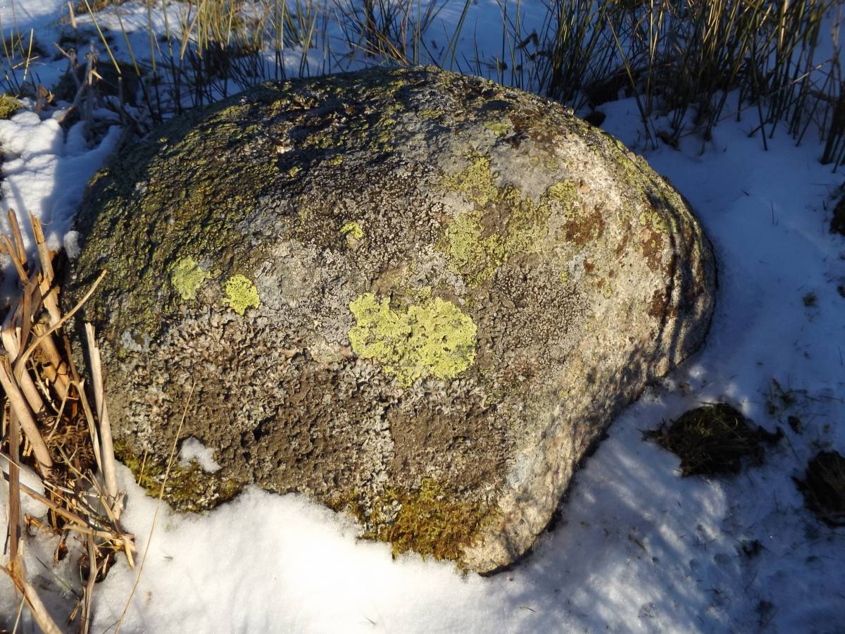
Rock No 1 Located close to the Moor Road on the bank of the prehistoric enclosure at Greystones,
Rock No 2 Located in heather close to one of the sources of Nor Beck at East Langbaugh.
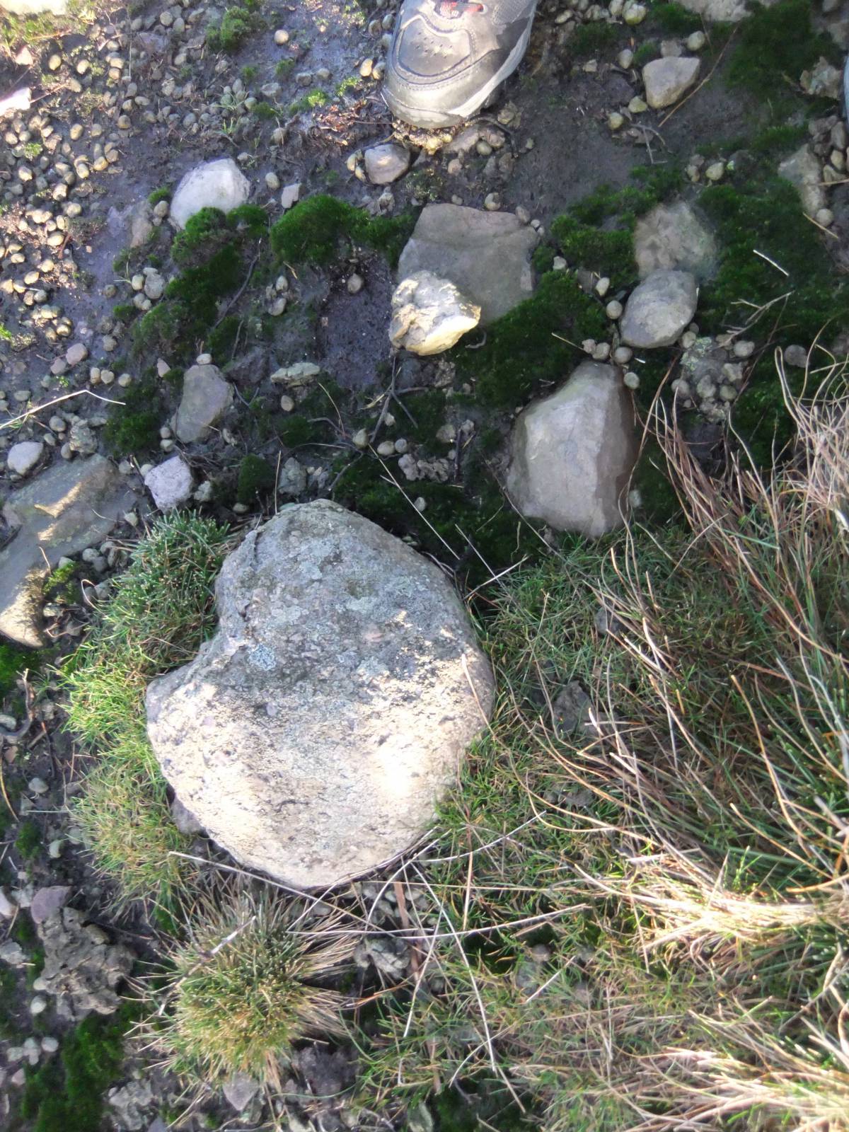
Rock No 3 Located close to the Badger Way Footpath at the head of Scale Knoll Gill. This small boulder lies within a group of rocks which include a cup and ring marked standing stone and an earthfast triangular boulder with a single bisecting pecked groove.
Reference Stan Beckensall and Tim Laurie, 1988. 'Prehistoric Rock Art of Co. Durham, Swaledale and Wensleydale', Durham County Books.The C&R Standing Stone referred to here as in the vicinity of Rock No 3 is that illustrated as Barningham 18, page 53.
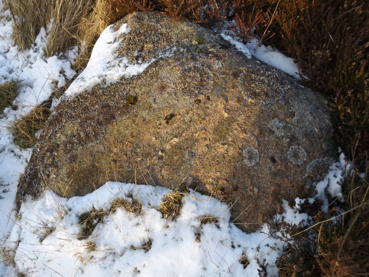
Rock No 4 Barningham High Moor. Shap granite Rock No 4 is a very small boulder (note the recent chip) located on Eel Hill at the edge of the High Moor escarpment at an elevation of 435m approx.
|
| Image 1 ID | 7171 Click image to enlarge |
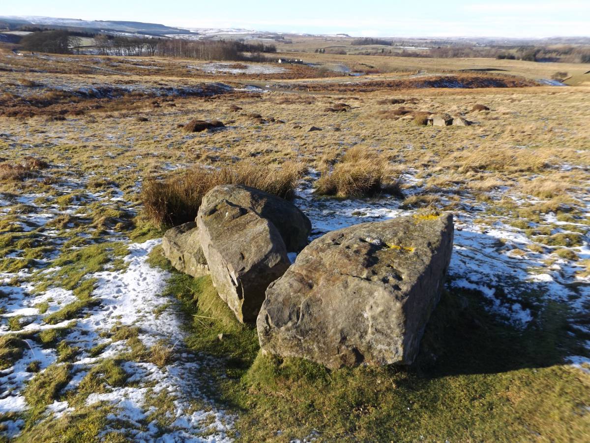
| Image 1 Description | Barningham Low Moor. Greystones. Rock No 1 Location of Shap erratic on bank of prehistoric enclosure. Cup marked rock in foreground. |  |
| Image 2 ID | 7172 Click image to enlarge |
| Image 2 Description | Barningham Low Moor. Greystones. Rock No 1 |  |
| Image 3 ID | 7173 Click image to enlarge |
| Image 3 Description | Barningham Low Moor. Greystones. Rock No 1 | 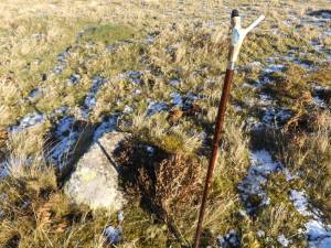 |
| Image 4 ID | 7175 Click image to enlarge |
| Image 4 Description | Barningham Low Moor. Greystones. Rock No 1 |  |
| Image 5 ID | 7184 Click image to enlarge |
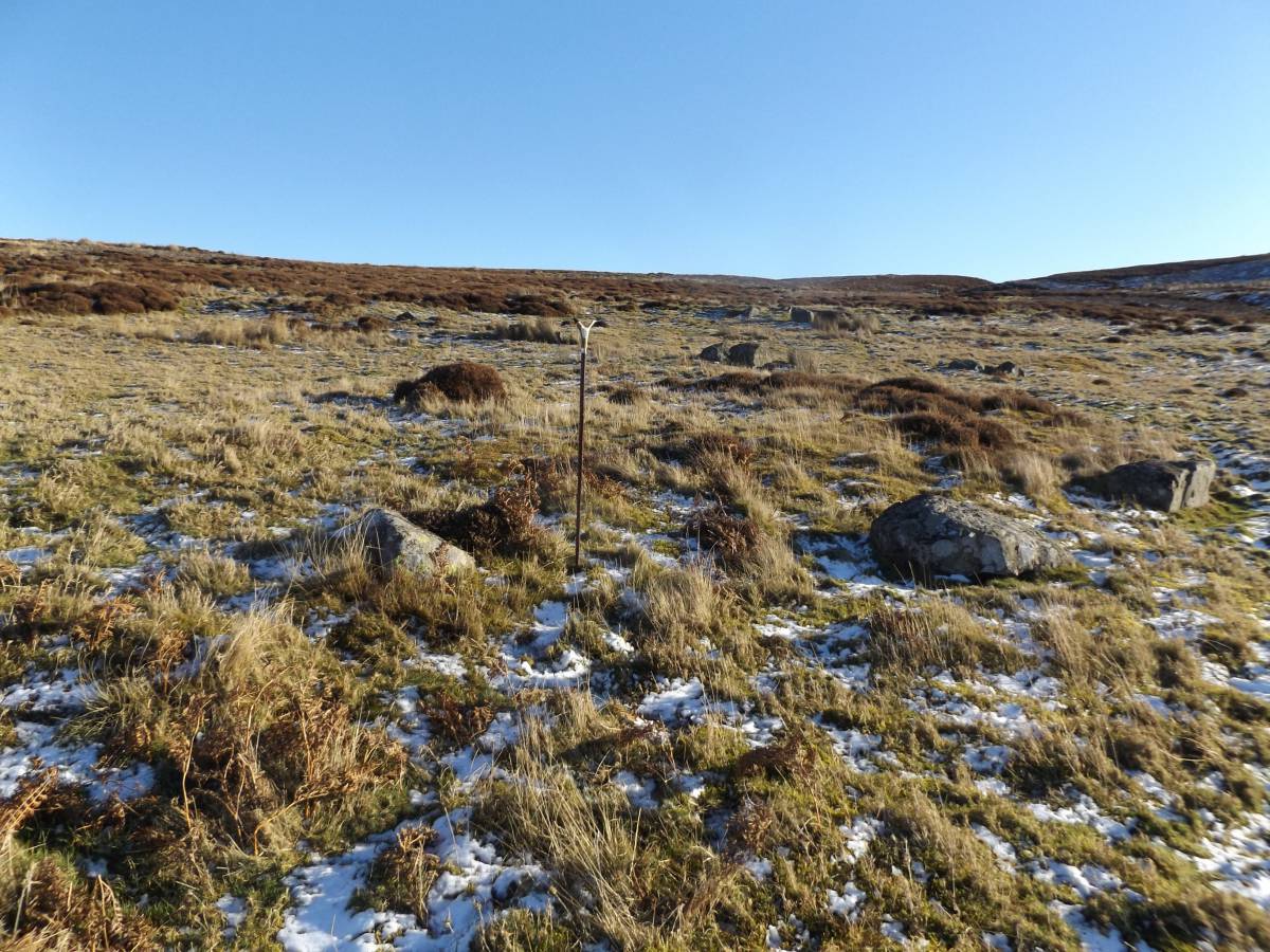
| Image 5 Description | Barningham Low Moor. East Langbrough. Rock No 2 | 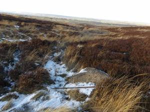 |
| Image 6 ID | 7185 Click image to enlarge |
| Image 6 Description | Barningham Low Moor. East Langbrough. Rock No 2 | 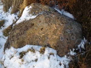 |
| Image 7 ID | 7177 Click image to enlarge |
| Image 7 Description | Barningham Low Moor. Rock No 3 located close to the Badger Way and upright rock decorated with cup and ring motifs. | 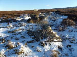 |
| Image 8 ID | 7178 Click image to enlarge |
| Image 8 Description | Barningham Low Moor. Rock No 3 located close to the Badger Way. Detail. The shap granite boulder is adjacent to the rock with the pecked groove. | 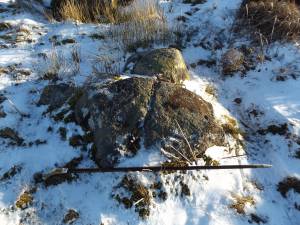 |
| Image 9 ID | 7179 Click image to enlarge |
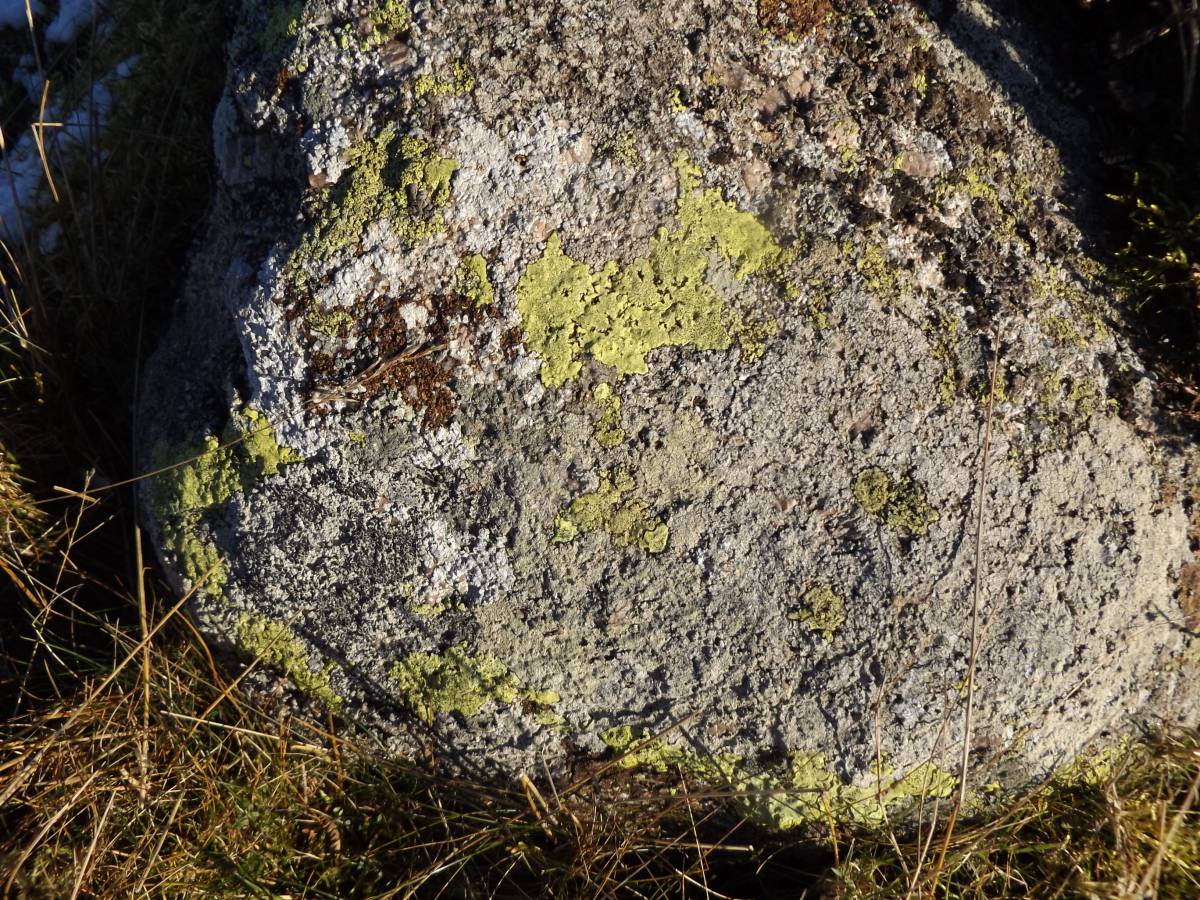
| Image 9 Description | Barningham Low Moor. Rock No 3 located close to the Badger Way. Close detail. |  |
| Image 10 ID | 7180 Click image to enlarge |
| Image 10 Description | Barningham Low Moor. Rock No 4. This small shap granite is located on Eel Hill at the very edge of the High Moor escarpment at an elevation of 435m approx. |  |
| Image 11 ID | 7181 Click image to enlarge |
| Image 11 Description | Barningham High Moor. Shap granite Rock No 4 is a very small boulder (note the recent chip) located on Eel Hill at the edge of the High Moor escarpment at an elevation of 435m approx. |  |
| Image 12 ID | 7182 Click image to enlarge |
| Image 12 Description | Barningham High Moor. Shap granite Rock No 4 is a very small boulder (note the recent chip) located on Eel Hill at the edge of the High Moor escarpment at an elevation of 435m approx. |  |
| Image 13 ID | 7183 Click image to enlarge |
| Image 13 Description | | 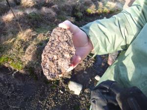 |
| Image 14 ID | 7184 Click image to enlarge |
| Image 14 Description | | |